|
This site has information for over a dozen hikes in the Ruby Mountains. These are on and off trail hikes from one end of the Rubies to the other including the Ruby Crest Trail and a couple of loop hikes.
Please be advised
Hiking Season in the higher elevations can vary from early July to the middle of October. This is determined by the winters snow pack. I plan all of my big hikes in August and September. These are the months I consider Prime Time.
The hikes below are listed in order of my difficulty. The times I give for these hikes are my times and distances that are listed are one way. So Please plan accordingly.
Trail Heads
Easy Hikes:
Nature Trail = A walk for ALL ages with benches along this mile long trail.
Lamoille Lake = 2 mile, 50 min, trail hike.
Island Lake = 2 mile, 50 min, trail hike with a lot of switch backs.
Liberty Pass = 3 mile, 1:45 min, trail hike. It's 1 mile past Lamoille Lake and a couple of minutes from the Liberty Lake Overlook.
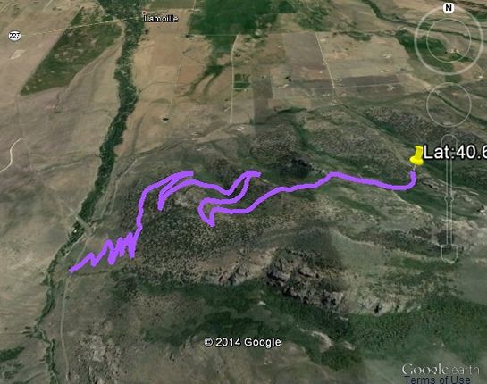
Lamoille - Talbot Trail = This trail is under construction with 4.1 miles of the trail complete as of June 2014.
A little Harder Hikes:
Griswold Lake = 3.5 miles, 2 1/2 hours, with trail (kind of) and access is restricted by Spring Creek Association.
Favre Lake = 5 mile, 2 1/2 hour, trail hike, Located past Liberty Lake.
Overland Lake = 5.5 mile, 3 hour, trail hike on the Ruby Valley side of the Rubies.
Really long day or overnighter:
Ruby Dome = 6 mile, 1 day, on/off trail hike to the highest peak in the Rubies (11,387 ft.)
Echo Lake = 6.5 miles, 1 day, on/off trail. This is the largest lake in the Rubies and also one of the hardest to get to.
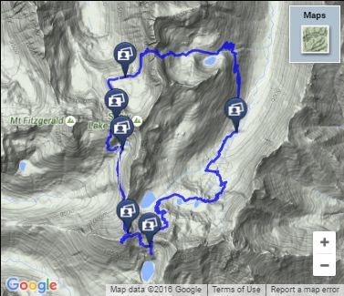
Little Lakes Loop Hike = 10.5 miles, 1 day, on/off trail. A smaller version of the Lakes Loop Hike.
Definitely at least 1 night:
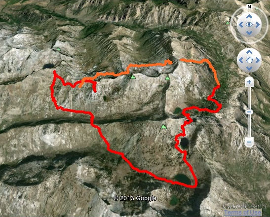
Lakes Loop Hike = 19 mile, 1 1/2 day, on/off trail hike. The best loop hike in the Rubies and one of my favorite.
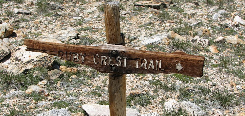
Ruby Crest Trail = 32 mile, 2 day on trail and nationally recognized.
|
The Nature Trail is an easy hike around 1 to 1 1/2 miles long. The trail head is located half way up lamoille canyon on the right side of the road. There is an area along the side of the road to park and benches are located along the trail. This trail is for just about everyone. You start out at the road where you parked and walk down to the creek and then loop back up to your car. This trail will take you through groves of aspens and along a rocky creek bed which is great for pictures.
[map - none, but if you like maps it's on 7.5 minute lamoille map. This trail is not shown]
|
|
|
This is a very nice hike. The Humbolt National Forest Service says this hike is 2 miles long. The trail to Lamoille Lake is part of The Ruby Crest Trail and the trail head is at the Roads End. Go to the very back of the loop in the road and you will find the trail head. It takes me 50 minutes to hike this by myself or 1:10 min. with my family taking our time. This hike is not as steep as the trail to Island Lake. The hike will take you passed Dollar Lakes. This is a trail that is heavily used and in good condition. I have seen a lot of deer on this part of the trail. I like the large trees and the view of the mountains that you have along the whole trail.
[map 7.5 minute Ruby Dome]
|
|
The trail head for Island Lake is located where the road splits to make the loop for the turn around at the end of Lamoille Canyon. When I tracked this the mileage came out to 1.7 miles. The hike takes me 50 min. alone and 1 hr. 20 min. with the family. (two children under 12) This is a really nice hike. The trail is steep but there are a lot of switch backs to level things out. I have seen Mountain Goats up behind the lake. The trail is always in good shape. Wild flowers are all over the side of the hill in the spring. I think this hike is harder than Lamoille Lake because it is steeper. Keep in mind it takes around the same time to hike to both Lamoille & island Lake. [maps needed 7.5 minute Ruby Dome & Ruby Valley School]
[map 7.5 minute Ruby Dome]
|
|
Liberty Pass is a mile passed Lamoille Lake for a total distance 3 miles. The pass is at the boundary to The Ruby Mountain Wilderness Area. I can get to Liberty Pass in 1:30 - 1:40 min. You will gain a lot of elevation once you pass Lamoille Lake but there are a lot of switch backs which levels things out. When you get to the pass keep walking for a couple of minutes and keep following the trail into the wilderness. The scenery gets better with every step. If you walk for a few minutes, you can arrive at an overlook to Liberty Lake. If you look passed Liberty Lake from the overlook you can see Castle Lake in the background. Note : Favre Lake is between Liberty and Castle Lakes but you can't see it because its elevation is a good bit lower than both Liberty or Castle Lake.
[map 7.5 minute Ruby Dome]
|
|
Click on the map on the right to go to the Lamoille Talbot Trail page on this site. -->
|
|
|
Follow the directions to Spring Creek Campground that can be found on the Trailhead page on this site.
Once you are at the end of the road in the campground follow the trail up the canyon. Part of the way up the trail you will run into a lot of rocks that will make the trail impossible to follow. Keep an eye out for piles of rocks that other hikers use as trail markers. I have been up to Griswold a lot of times and I rarely take the same exact way twice in a row. If you go up late in the year the trail is pretty easy to follow because of the people who were on the trail earlier in the year. If you loose the trail just keep your sights aimed up the canyon and eventually everything will work out. Griswold Lake sits in the back of this canyon so you can't miss it. It takes me around 2-2:20 min. to get to the lake.
[maps needed 7.5 minute lamoille & Noon Rock]
|
|
|
When you get to Liberty Lake just keep following the trail and it will take you right to Favre Lake. It takes around 2:25 hr. from the parking lot to Favre lake. From Liberty Pass to Favre is all down hill. There are actually two ways to get to Favre. One of the ways I have already mentioned, just follow the Ruby Crest Trail passed Liberty Lake and the other way (and the one that I prefer) you follow the Ruby Crest Trail to Liberty Lake and when you get to the lake walk over to where the lake drains out and from there you can find a trail that will lead you down the hill and to your left (when your back is to Liberty Lake).This trail brings you into the backside of Favre.
[map 7.5 minute Ruby Dome]
|
|
|
To get to Overland Lake use the Trailhead page on this site. It takes me around 1:15 minutes to drive from the light in Spring Creek to the trailhead.
This is one of the few trails on the south side of the Ruby Mountains. On your way to Overland Lake you will have a beautiful view of Ruby Valley and Franklin Lake. This hike is on a good trail that leads from the edge of Ruby Valley into the heart of the Ruby Mountains. The last ten minutes of this hike is on the Ruby Crest Trail. From the trail head to Overland Lake takes me around 3:00 hours. When doing this hike be ready for a lot of switch backs and be sure to bring a pair of binoculars because I have seen a lot of deer early in the mourning from the trail. This hike can be hot toward the bottom and there is no place to get water along the trail until you get to the lake.
[maps needed 7.5 minute Franklin Lake NW]
|
|
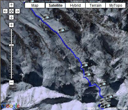
Click on the map on the right to go to the Ruby Dome page on this site. -->
|
|
|
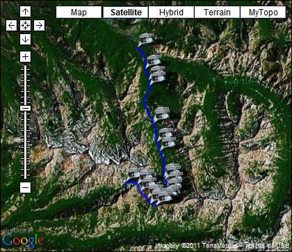
Click on the map on the right to go to the Echo Lake page on this site. -->
|
|
|
Click on the map on the right to go to the Little Lakes Loop Hike page on this site. -->
|
|
|
Click on the map on the right to go to the Lakes Loop Hike page on this site. -->
|
|
|


