|
Points of Interest in Lamoille Canyon
Powerhouse Picnic Area
Located 2.25 miles from Lamoille Highway (SR227)and is at the mouth of Lamoille Canyon. Overlooking this picnic area is parking for the Sercet-Lamoille Trail.
Link to the Forest Service Powerhouse Picnic Area Page.
Waterfall (Spring Only)
1.4 miles from turn off into Powerhouse Picnic Area. From the mouth of the canyon to this point is a great place to look for bighorn sheep.
Scout Camp / Camp Lamoille
2.7 miles from turn off into Powerhouse Picnic Area.
Glacier Overlook
3.2 miles from turn off into Powerhouse Picnic Area. This pull off has signs that explain how glaciers made these canyons. This is an overlook for Camp Lamoille and into Right Fork Canyon behind Camp Lamoille.
Pete's Point
4 miles from turn off into Powerhouse Picnic Area. This is another overlook for Camp Lamoille. This is also a great place to see mountain goats in the cliffs to the north and bighorn sheep on the slopes below the cliffs.
Thomas Campground
5.2 miles from turn off into Powerhouse Picnic Area.
Link to the Forest Service Thomas Campground Page.
Nature Trail
6.8 miles from turn off into Powerhouse Picnic Area.
Terraces Picnic Area
8 miles from turn off into Powerhouse Picnic Area.
Link to the Forest Service Terraces Picnic Area Page.
End of Road
10 miles from turn off into Powerhouse Picnic Area.
|
4 July 2015The Road and Snow Report Page has moved to our facebook page.You do not need to be a member of facebook to view this page. It has been a great 14 years on this page but let's face it, the facebook page has more info on it and is much easier to update than this page. So see you on facebook for up to date weather and trail info. The rest of the site will stay the same.
|

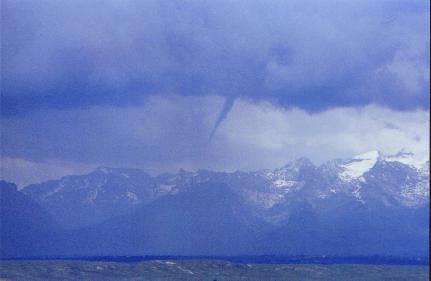
Lamoille Canyon is the canyon to the left of the photo.
|

